Point Reyes
Coastal bluffs, redwood groves, and wild Pacific shores - four days of walking through the Golden State's most dramatic seascape.
Explore this trek
Charlevoix
Laurentian mountain trails, St. Lawrence vistas, and Québécois village inns - five days of walking through Canada's first biosphere reserve.
Explore this trekThe Rhythm
How inn-to-inn walking works
A self-guided walking holiday gives you the freedom to explore on foot with the comfort of a reserved room and a hot meal waiting at the end of the day. Your luggage travels ahead. You just walk.
Walk by day
Follow marked trails at your own pace. Routes are 10-16 km per day with moderate elevation - no guide needed. Maps and GPX files provided.
Sleep in comfort
Each night brings a different inn, B&B, or auberge. Your luggage travels ahead so you walk with just a daypack.
Arrive the next day
Breakfast fuels the next leg. Your bags meet you at check-in. Linger in a village, soak in a view - the day is yours.
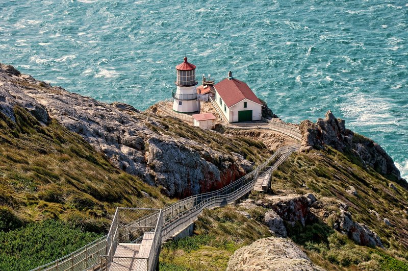
Point Reyes
Marin County, California · 4 days · 45 km
The Vibe
Wind-swept coastal bluffs, rolling fog, and the smell of salt and sage. Point Reyes is where the Pacific meets the pastoral - wild coastline, redwood canyons, and working dairy ranches. Expect dramatic light, tule elk on the headlands, and a quiet that feels ancient.
The Trek
A 4-day, 45 km point-to-point along the Coast Trail and Bear Valley corridors. Moderate elevation (200-400 m/day). Highlights: Limantour Beach, the Earthquake Trail, Alamere Falls, and the Point Reyes Lighthouse. Best walked April-October.
Lodging
Three nights at three distinct inns: a converted ranch house in Olema, a coastal B&B on Tomales Bay, and a historic lodge near the lighthouse. Each with private rooms, hot showers, and local farm-to-table dinners included.
Logistics
Self-guided with full route notes. Luggage transfer between inns included. Operated by Wildland Trekking and REI Adventures. Trailhead access via shuttle from San Francisco (90 min). Book 4-6 weeks ahead for peak-season availability.
Charlevoix
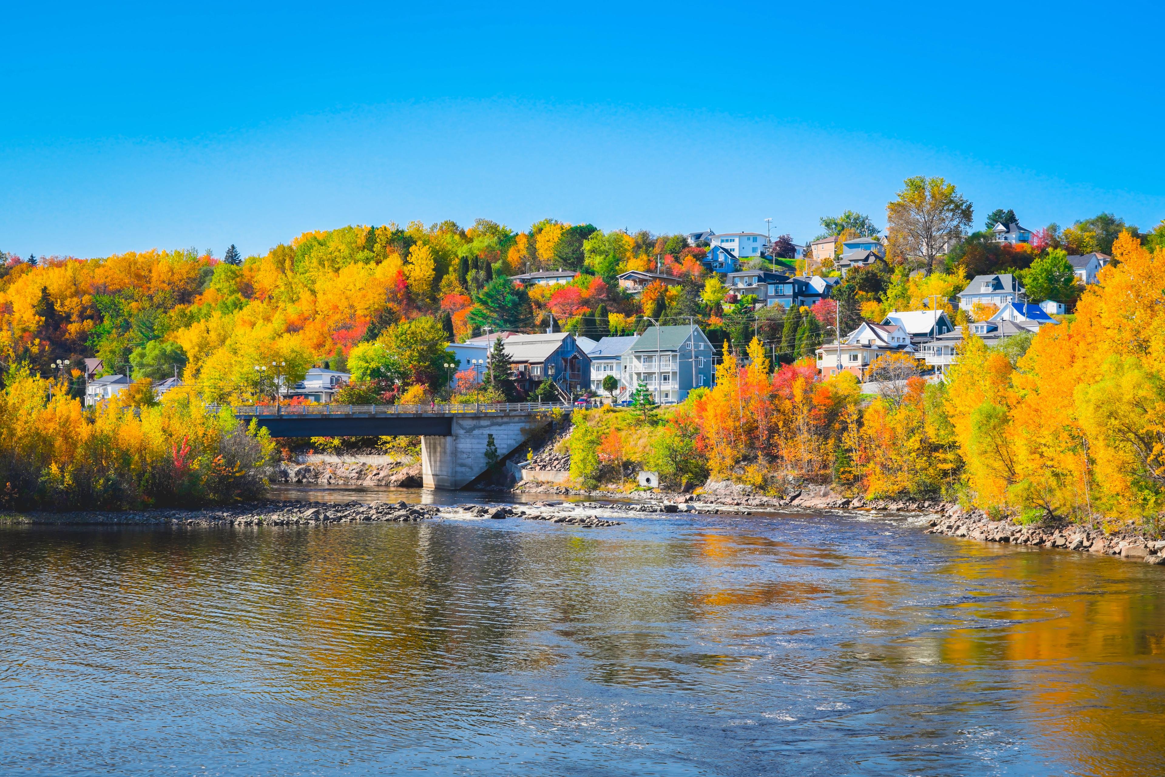
Québec, Canada · 5 days · 60 km
The Vibe
Laurentian forest gives way to the St. Lawrence River at every turn. Charlevoix is Québec's first UNESCO biosphere reserve: a landscape carved by a massive meteorite, dotted with whitewashed villages, and blanketed in sugar maple and balsam fir. The air smells of pine and river mist.
The Trek
A 5-day, 60 km point-to-point along the Sentier des Caps and Traversée de Charlevoix. Moderate elevation (300-500 m/day). Highlights: Hautes-Gorges canyon viewpoints, Baie-Saint-Paul's artist quarter, and the pounding tide of the St. Lawrence. Best walked June-September.
Lodging
Four nights in Québécois auberges and gîtes: a manor in Saint-Irénée, a farmhouse B&B in Les Éboulements, a riverside inn in Baie-Saint-Paul, and a forest lodge. Each dinner features regional specialties - tourtière, maple-glazed duck, fresh St. Lawrence seafood.
Logistics
Fully self-guided with detailed trail notes and waymarked paths. Luggage transfer between inns included. Booked through Sentier Charlevoix or Québec Aventure. Access from Québec City (60 min drive). French and English spoken at all lodgings.
Compare
At a glance
| Point Reyes | Charlevoix | |
|---|---|---|
| Duration | 4 days / 3 nights | 5 days / 4 nights |
| Total distance | 45 km (28 mi) | 60 km (37 mi) |
| Daily avg | 11 km / 350 m gain | 12 km / 400 m gain |
| Difficulty | Moderate | Moderate |
| Best season | April - October | June - September |
| Terrain | Coastal bluffs, forest | Mountain trails, river valleys |
| Luggage transfer | Included | Included |
| Start / End | Olema / Point Reyes | Baie-Saint-Paul / La Malbaie |
| Nearest city | San Francisco, CA | Québec City, QC |
Logistics
Plan your trip
Self-guided operators
Both treks can be booked as self-guided packages that include route notes, accommodation, luggage transfer, and emergency support. Wildland Trekking and REI Adventures cover Point Reyes. Sentier Charlevoix and Québec Aventure cover Charlevoix.
Luggage transfer
Your main bag (up to 20 kg) is collected from your inn each morning and delivered to the next. You walk with a daypack carrying water, layers, and lunch. Everything is pre-arranged - no luggage offices to find.
What to pack
Sturdy walking shoes or boots, a waterproof shell, layers (coastal weather changes fast), sunscreen, a reusable water bottle, and a small daypack. Trekking poles are optional but recommended for the Charlevoix descents.
Getting there
Point Reyes: fly into San Francisco (SFO), then a 90-min shuttle to Olema. Charlevoix: fly into Québec City (YQB), then a 60-min drive or bus to Baie-Saint-Paul. Both offer ample parking if you drive.
Booking tips
Book 4-6 weeks ahead for peak season (July-September). Single travelers pay a small supplement. Most operators offer flexible cancellation up to 14 days before. Travel insurance covering cancellation and medical is strongly recommended.
Language & culture
Point Reyes: English, casual California style. Charlevoix: French is the local language - innkeepers speak English, but a few words of merci and bonjour go a long way. Both regions welcome walkers warmly.
Ready to walk
Two trails. One decision.
Whether you choose Pacific bluffs or Laurentian peaks, your bags are transferred, your bed is booked, and the trail is waiting. Share this page with your walking partner and start planning.